 Premium content is for our Digital-only and Premium subscribers. A Print-only subscription doesn't qualify. Please
No-Till Farmer
Get full access NOW to the most comprehensive, powerful and easy-to-use online resource for no-tillage practices. Just one good idea will pay for your subscription hundreds of times over.

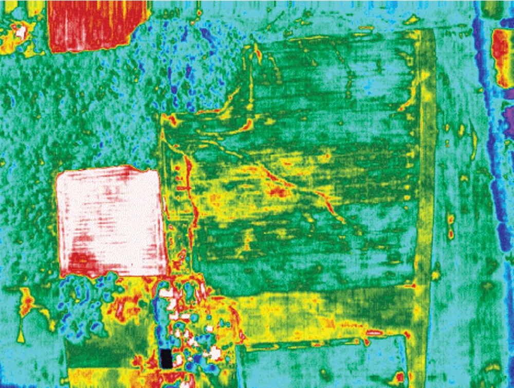
Most no-tillers think of aerial imagery as a scouting tool. Brian Sutton agrees it is great for scouting, but says farmers really see an ROI with the technology when they use it to create planting and fertilizing prescriptions.
Sutton is a no-tiller and pilot based in Lowell, Ind., who founded AirScout and its proprietary Thermal Imagery. Using an infrared thermal camera that captures three-one-hundredths of a Celsius degree, AirScout takes photos of fields throughout the season to create prescription planting and fertilizer maps based on 6-inch pixels.
At the 2026 National No-Tillage Conference in St. Louis, Sutton explained how the technology works and can be used to drive in-season nitrogen (N) management decisions.
Many prescription maps are built on maps from the Soil Survey Geographic Database (SSURGO). Sutton calls this, “The biggest detriment to precision agriculture that will ever exist.”
The reason is due to a lack of consistency in how the maps were made, illustrated by Figure 1. Despite following the same instructions from the Univ. of Iowa, the three surveys conducted at the same location resulted in very different soil maps.
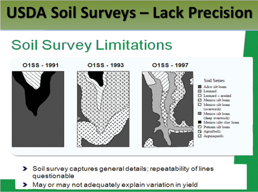
FIGURE 1. SURVEY INCONSISTENCIES. An experiment by the Univ. of Iowa had different groups of people map the same ground in three separate years. Despite following the same instructions, the survey takers all came up with very different maps. Univ. of Iowa
“SSURGO was never meant for precision ag,” Sutton says. “It had an entirely different purpose and they never dreamed…

Get full access NOW to the most comprehensive, powerful and easy-to-use online resource for no-tillage practices. Just one good idea will pay for your subscription hundreds of times over.
Download these helpful knowledge building tools

We have engineered and developed the most advanced concave system that threshes all crops, eliminates rotor loss, improves grain quality, gives you a cleaner sample – all with one set of XPR concaves.

At Titan International, our product portfolio reflects our commitment to innovation and high-quality products. Titan International offers a full line of solution-focused wheel, tire, and undercarriage products for a wide variety of off-the-road equipment in agriculture, construction, forestry, mining, power sports, high-speed trailers, and outdoor power equipment segments. As one of the largest North American manufacturers, with a network of dealers all over the world, Titan is an industry leader that original equipment manufacturers and operators can count on for durable products and quality service.

Provide expert analysis and decision support to increase productivity and profitability.