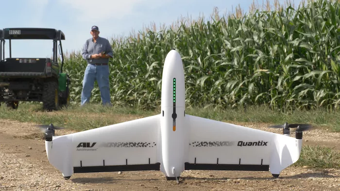
AeroVironment's Quantix Mapper is a quick and easy-to-use mapping solution, delivering high-resolution imagery on the spot — no other devices, internet or software required. With the touch of a button, its user can quickly generate up-to-date maps for in-field assessments while having the flexibility to export data to third party analytic processing platforms.
Quantix Mapper can survey 400 acres per 45-minute flight and deliver up-to-date georeferenced maps as soon as the drone lands. Efficient mapping modes allow users to choose between line (corridor), area and waypoints for targeted mapping. Three adjustable flight altitudes (360, 265 and 150 feet) make it easy for users to vary the coverage rate and image resolution for their mapping needs. Built-in dual 18-megapixel cameras allow Quantix Mapper to capture both true color and multispectral georeferenced imagery all in one pass.
For added flexibility, Quantix Mapper data is nonproprietary and compatible with a wide range of GIS analytics tools for further analysis.
Learn more at www.AVDroneAnalytics.com.