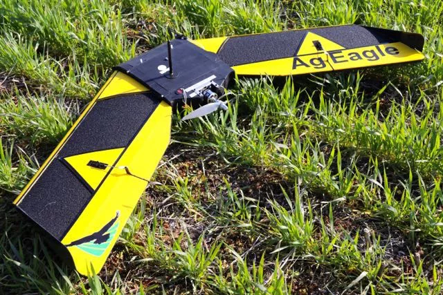
The AgEagle RX48 Drone boasts a true NIR global shutter sensor that is capable of creating extremely accurate prescription maps for the application of chemicals and nutrients from a precision application tractor.
The fixed wing drone covers significantly more acres than multicopter drones and does it more efficiently. The RX48 can cover 300 acres or more in just about any kind of weather.
Although it weighs only 4 pounds, the RX48 is just as robust as the original AgEagle. Being constructed of durable polypropylene material covered with a composite layer of extruded polypropylene and carbon fiber rods imbedded in the wing and fuselage makes it the most durable hand launchable fixed wing drone in industry.
Post flight images are conveniently stored on a micro SD that can be uploaded for processing post flight. Additionally, AgEagle is the only UAV manufacturer to offer Version LTE data inflight image transfer for rapid processing of aerial images. This means while the RX48 flies, images are transferred through the LTE data system so the creation of aerial maps is done rapidly and automatically, leaving the agricultural professionals to focus on increasing crop yields rather than processing aerial images.
For more information, please visit www.AgEagle.com.